
Lower & Middle Falls, Rochester


Location: Downtown Rochester, Monroe County, New York.
Maps: Google Map; Topographic; Genesee Valley Greenway Trail Map (PDF); Fishing access map; Interactive map.
GPS Coordinates:
- Lower Falls: (N 43.1796, W 77.6277)
- Middle Falls: (N 43.17664 W / 77.62798)
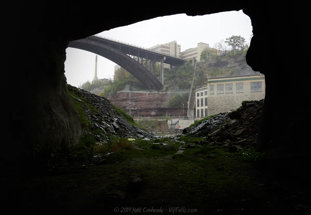
- Lower Falls cave: (N 43.17939 / W 77.62870)
Directions: From the East:
- Take 104 Clinton Ave N. Head south to Norton St. and make a right.
- Make a left on St. Paul St. and then a right onto Driving Park Ave.
- Park in the Maplewood Park parking lot on the right.
From the West:
- Take I-390 to Lexington Ave. Follow it east and turn left on Lake Ave.
- Make a right at the next intersection onto Driving Park Ave.
Use Google Directions to get to Maplewood Park.
Park in the Maplewood Park parking lot on the left. Alternate viewing for Lower Falls: You can view this falls from the other side via the RG&E access road on the east side of the falls.
Use Google Maps to get the Seth Green Blvd.
Park in the small fishing access site parking area on Seth Green Blvd.
Weather
Information / Accessibility / Accommodations
Number of falls: 2.
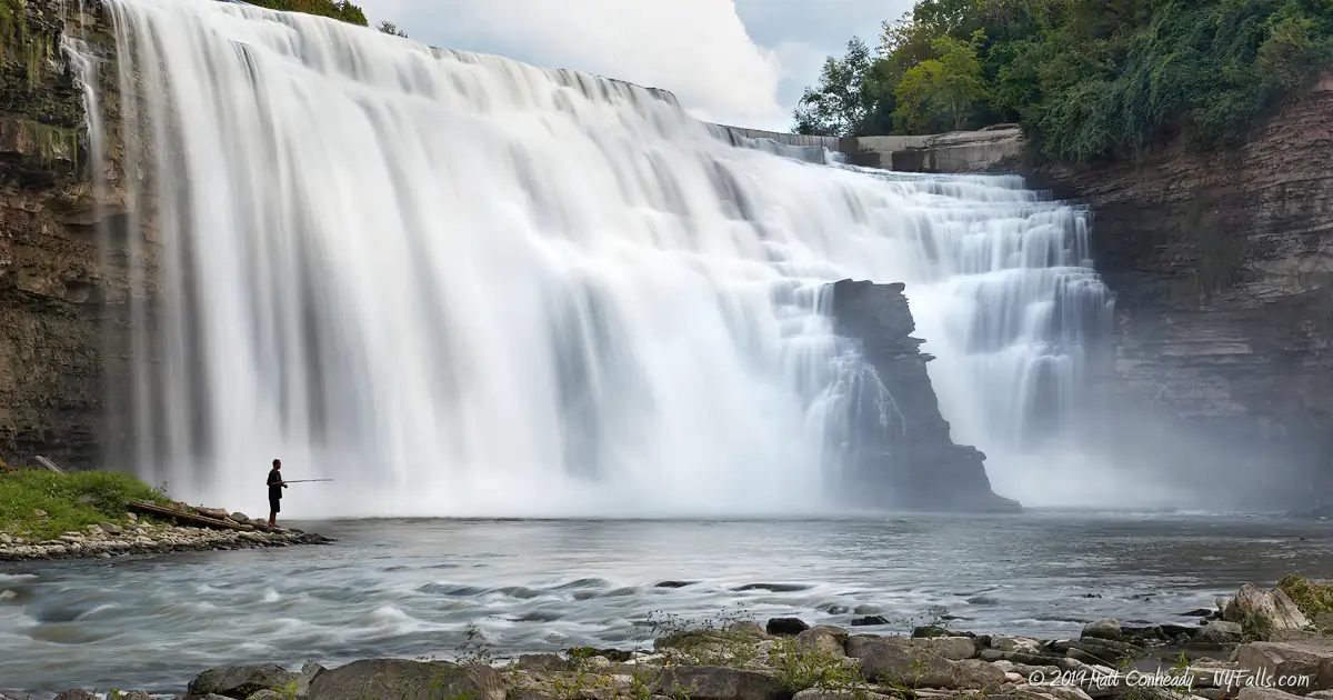
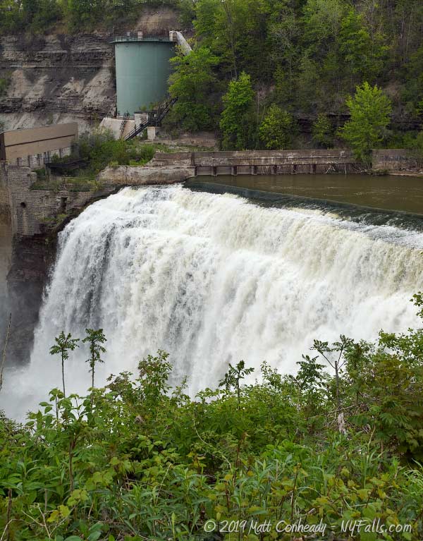
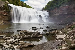
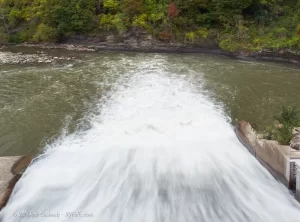
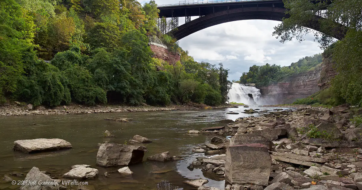
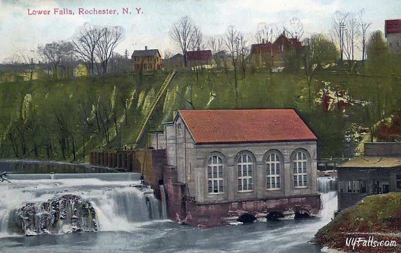
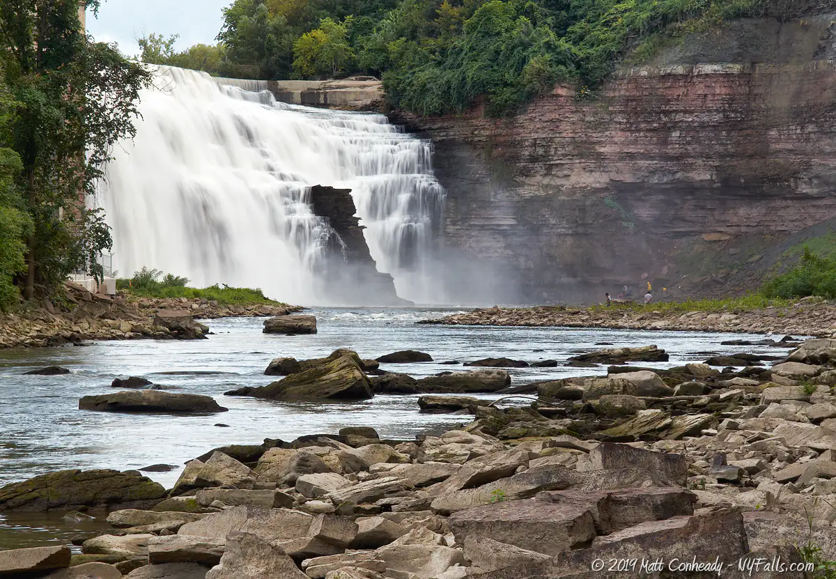
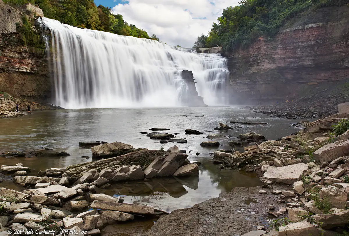
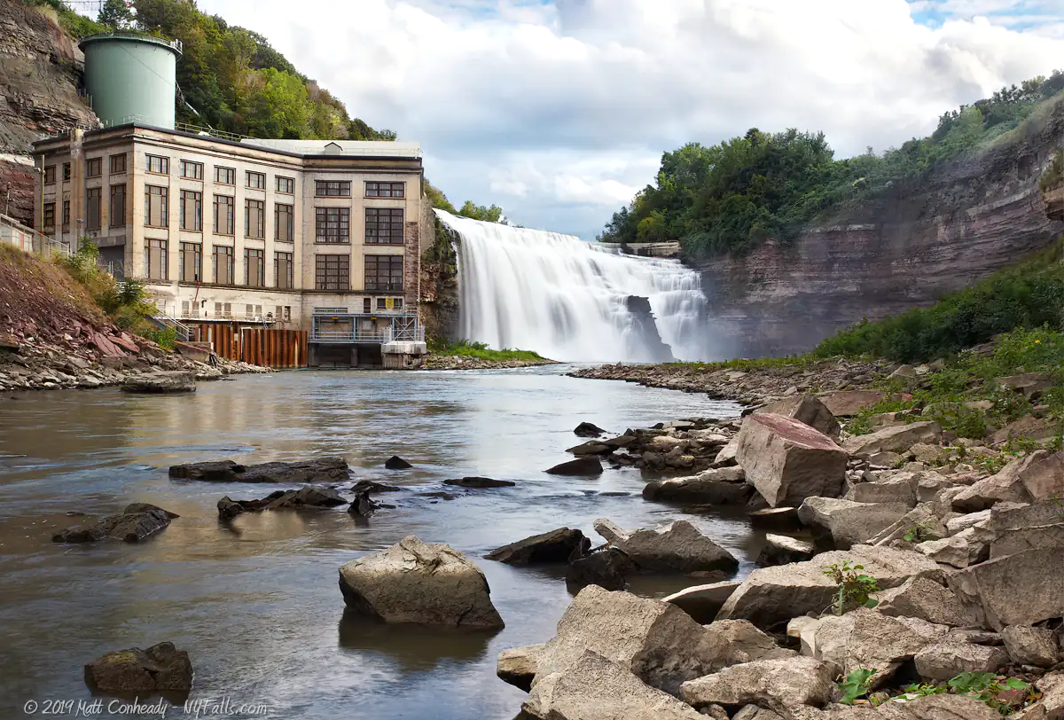
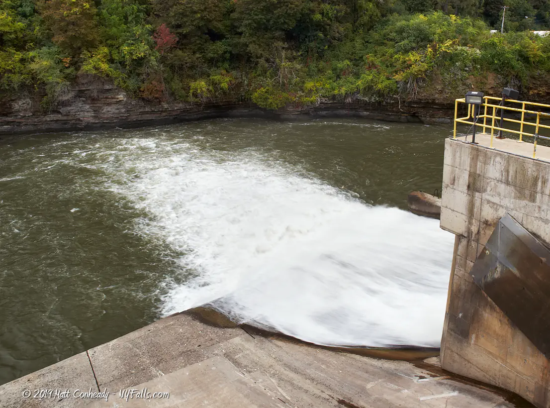
Size/Types: Lower Falls is a massive 110 ft tall cascade in a U-shaped gorge. The top of the falls is capped with a small dam to help keep the flow of water to the adjacent power plant reliable. Middle Falls only exists as a hydroelectric dam.
Best time to visit: Late spring through winter.
Flow: High. During levels of high snow-melt or rain, the gorge below the falls may flood.
Waterway: The Genesee River, a large tributary to Lake Ontario to the north. The Genesee River also flows over High Falls, just to the south, and further south, the three large waterfalls of Letchworth State Park.
Time: You can spend a few minutes seeing the falls from the Driving Park Bridge, which is just a short distance from Maplewood Park, or you can spend a few hours or more exploring Maplewood Park and working your way down to the base of the gorge. On the other side of the river, the fishing access site is a short 10 minute walk down into the gorge to the river.
Seasons/Hours: Open year-round. Maplewood Park is open daylight hours only. Gorge access is prohibited at night and when water levels are high (this can be very dangerous).
Admission: Free.
Handicap accessibility: Sections of Maplewood Park are accessible.
Pets: Allowed on a leash. For the safety of your pet and other hikers, do not bring your pet on any trails near or in the gorge. It’s dangerous for your pet and for other hikers. Use some common sense.
Swimming: Do not swim in the Genesee River.
Accommodations: Hiking; fishing; historical information; Maplewood Park also has: restrooms; playing fields; rose garden; gazebos; fishing pond; tennis courts; picnic tables.
Description
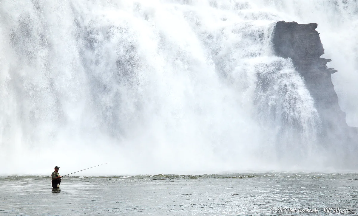
Rochester’s Lower Falls is an easy waterfall to view, but a difficult one to photograph. Like the other waterfalls of the Genesee, the Rochester Lower Falls has a rich history of development and exploitation. Today the falls is still used for electric power generation on one side, but opposite the RG&E plant is a beautiful series of connected parks over what was once a thriving milling and shipping industry along the river, offering visitors a glimpse of this powerful falls in a more natural state than in its recent past.
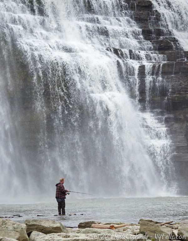
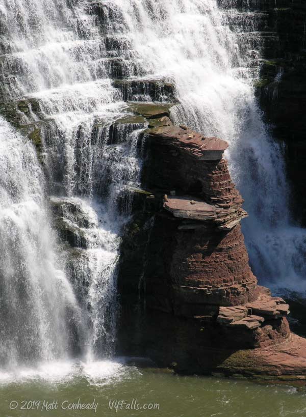
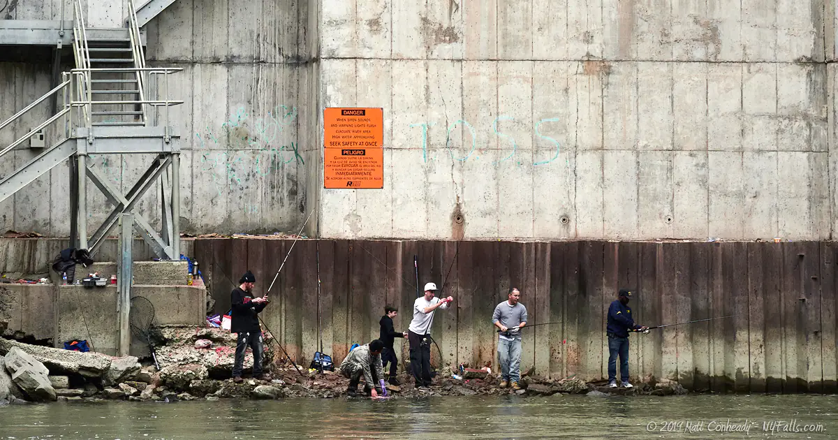
The crest of Lower Falls is artificial; a man-made dam several feet high that not only serves its intended purpose of regulating flow for the electric generators, but also spreads the water out for a more even tumble down the sandstone rock. One interesting characteristic of this falls is the stone pillar, dividing the falls in two mid-way down, that gives the falls a unique look. Occurring at a bend in the river, the falls empties into a wide gorge, with a massive limestone wall on the east end opposite the falls. The dominating characteristic is the muted yellow Rochester Gas & Electric substation that hugs the eastern flank of the falls. The property is mostly off limits, but the DEC has allowed access down the utility road leading to the base of the plant. Visitors can come down to the gorge and almost to the base of the falls for fishing and viewing. It’s an amazing experience.
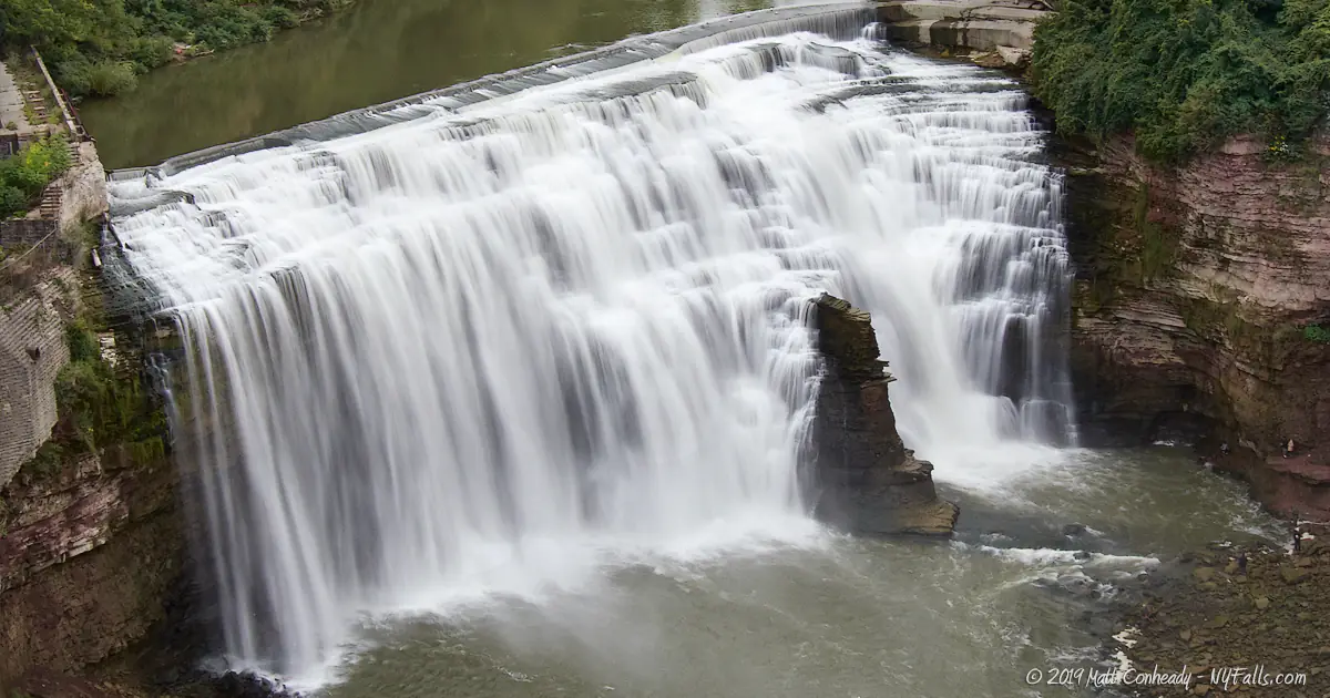
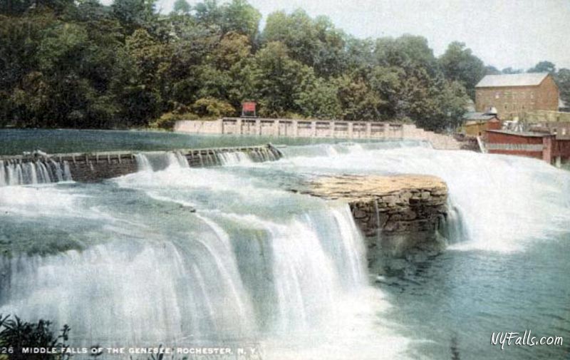
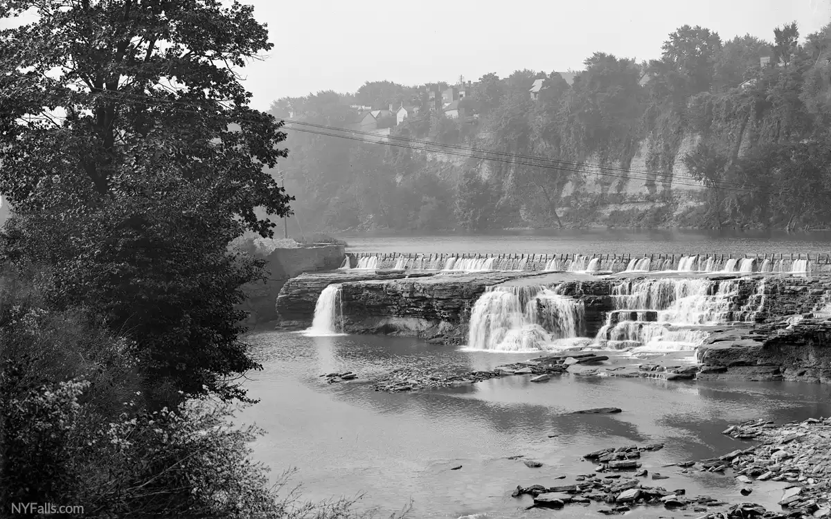
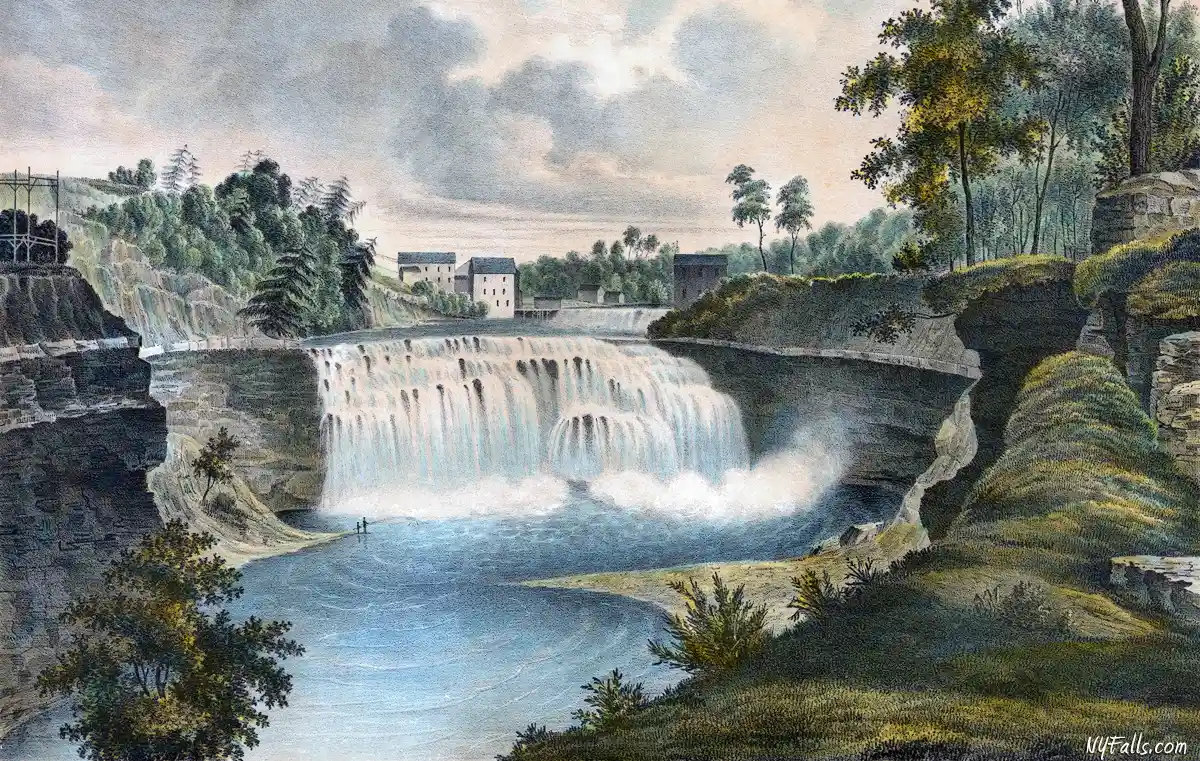
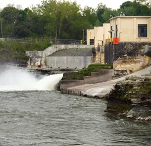
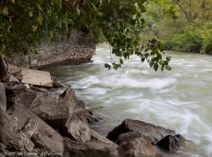
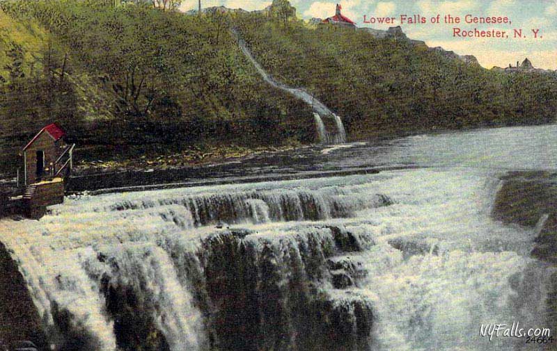
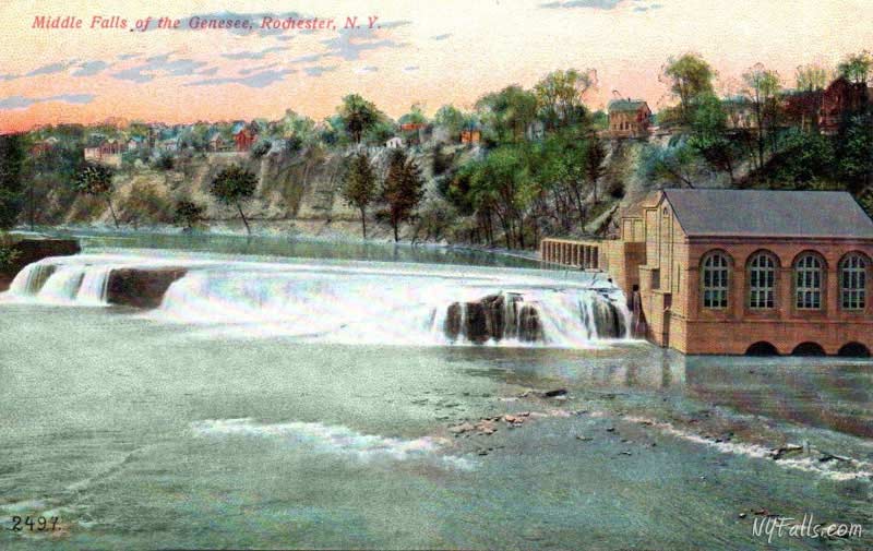
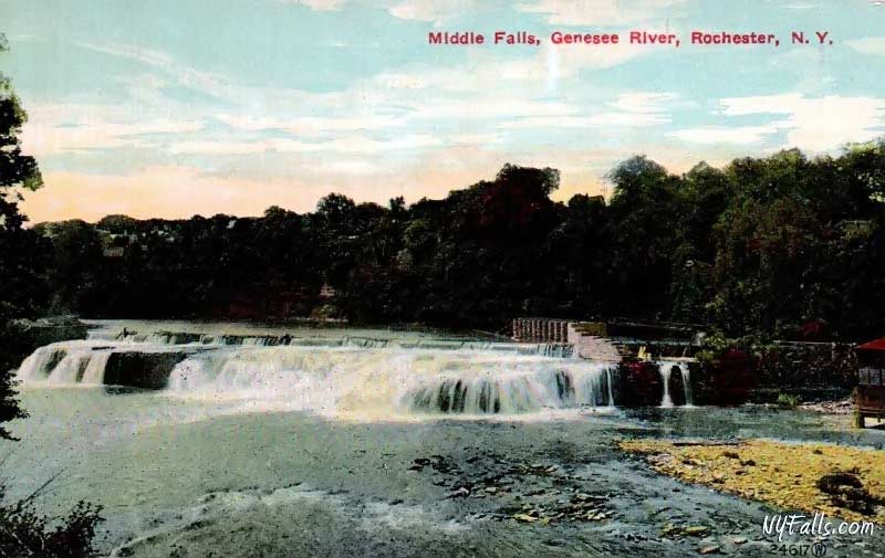
Middle Falls is no more. Once a wide cascade, roughly a dozen feet in height, it has been capped with a hydroelectric dam and the water below it has been flooded with the backed up waters from the Lower Falls dam. In between the two falls, the water is turbulent and dangerous. A beautiful falls-view park, appropriately named Lower Falls Park, sits upon the site of an old milling community just upstream from the crest of the falls. Here you can see right over the crest and also the rapids in-between. In recent years, a trail has been open allowing visitors to walk across the Middle Falls dam. From there one can see the water rushing over the dam, as well as the calm waters upstream.
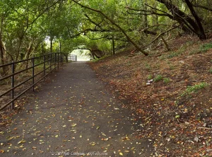
From the Driving Park Bridge, one can see the falls in all its glory, albeit through a high chain-link fence, making photography from this point a challenge. Another wonderful option for adventurous hikers is to venture down into the gorge from Maplewood Park. Although not an official trail, and often unstable in times of rain, this centuries old path will get you down to the western banks of the river. Meander over wet stones and trash, through the mist and mud, and you can find yourself at the base of the falls.
History
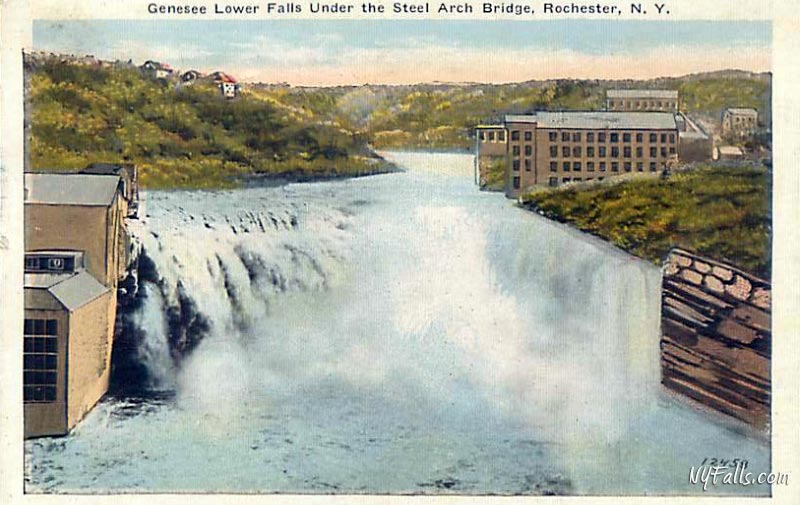
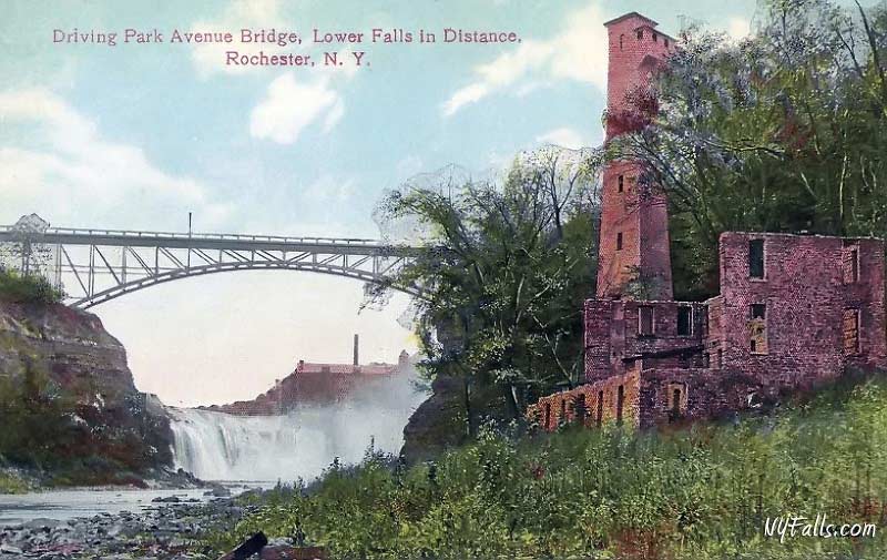
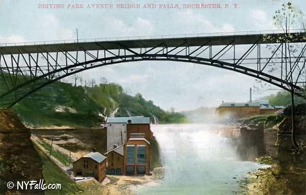
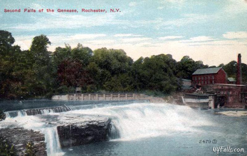
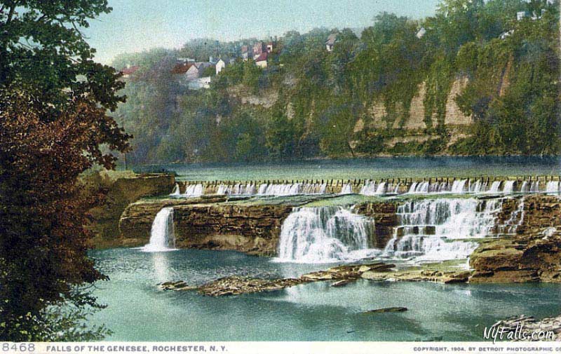
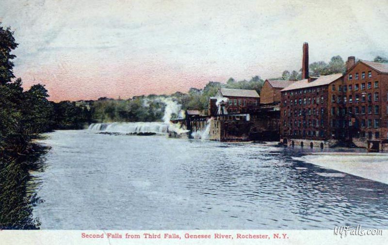
Throughout its history the Middle and Lower Falls gorge has been home to a variety of early settlements, the most prominent being McKrackenville, an industrial mill center founded sometime around the 1820s by Dr. David McKracken. Water was diverted from Middle Falls and run through a race east of what is now Lower Falls Park.
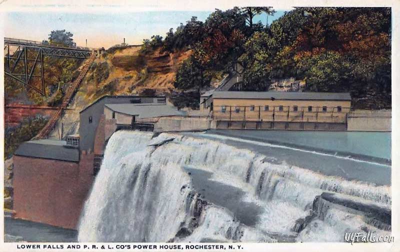
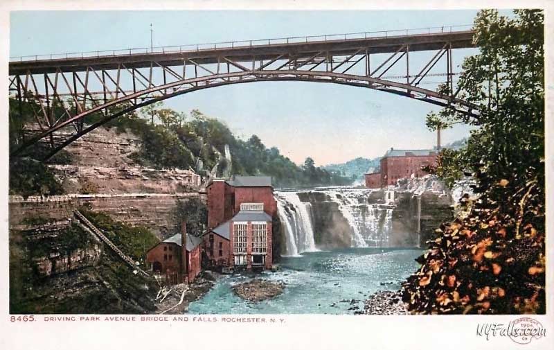
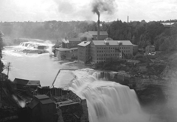
For over 120 years, McKrackenville thrived as a milling community, home to paper mills, carpet mills, flour mills, a trunk factory, furniture factory and more. In the late 1800s, a power station was built at the Lower Falls to produce compressed air for industry. It operated for 20 years. Afterwards, a small hydroelectric station (#5) was built atop the falls, and it was eventually complemented in 1906 with a larger station (#15). As the advent of electricity allowed factories to expand beyond the confines of water power and build plants elsewhere in the city, McKrackenville declined and was eventually abandoned.
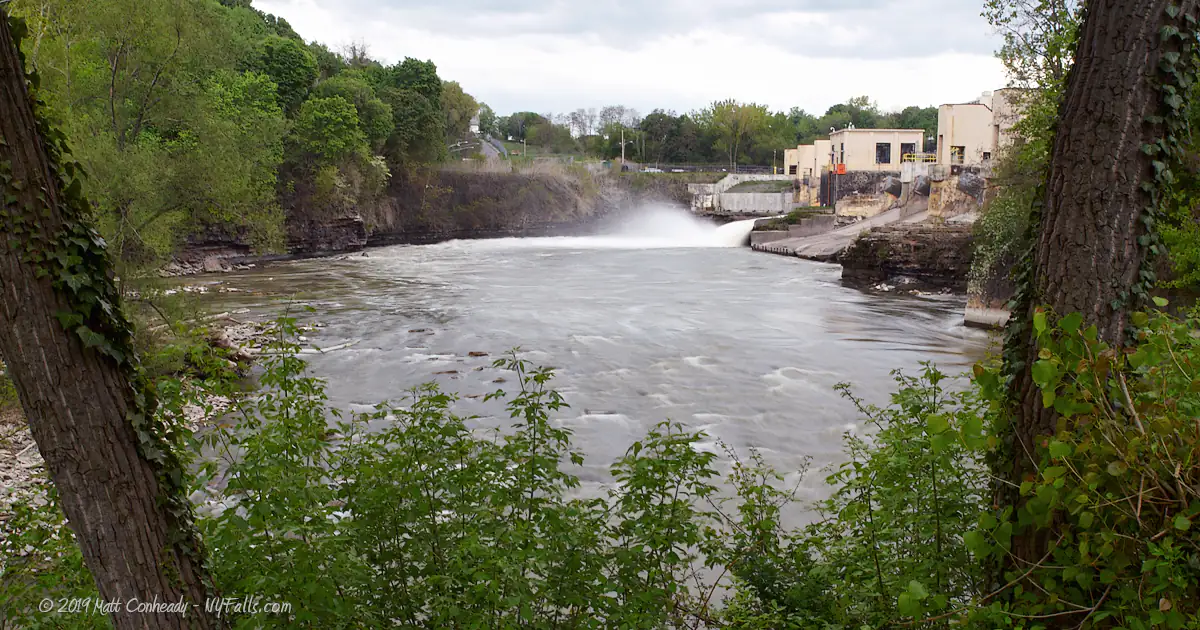
Rochester Gas & Electric, the public utility, obtained the rights to power at Middle and Lower Falls in 1917 and replaced stations 5 and 15 with a new 22 ft high dam and power station (named “Station 5 Powerhouse). The dam greatly increased the height of the water behind Middle Falls and completely hid the natural appearance of the falls. Water retained by the Middle Falls dam is channeled through a network of tunnels through the bedrock and into the turbine station located on the east side of Lower Falls. The station generates about 47,000 kilowatts per hour, enough to power 24,000 homes.
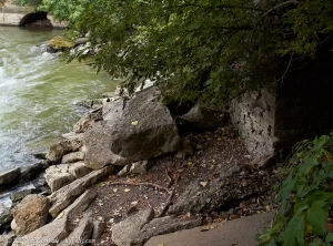
Lower Falls Park still contains the foundations of the numerous mills that once existed here. In the early 1960s it was filled in with stone landfill from the excavation of Midtown Plaza, and wasn’t turned into a park until 2001. The foundations of the mill complex can still be seen along the edge of the water as well as the western edge of the park along the cliff.
Take a look at McCrackenville-era views of Lower and Middle Falls with these vintage post card images. Will we ever reclaim Middle Falls and be able to visit it in a natural state? Probably not.
Hiking / Walking Trails
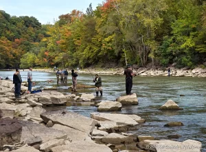
The DEC Fishing Access Site (east side of the Middle Falls)
Difficulty: Easy.
Markings: DEC rules and regulations sign at the beginning of the access road.
Distance: Less than a half-mile walk down a paved road to the bottom of the gorge.
Description: From the DEC parking area off of Seth Green Blvd, head south (and downward) on the access road. It will descend into the gorge and under the Driving Park Bridge. It ends at the power plant’s water outlet.
The Driving Park Bridge (Lower Falls)
Difficulty: Easy.
Markings: None.
Distance: A few hundred feet.
Description: From the Maplewood Park parking lot off of Driving Park, head towards the street, and cross it towards the YMCA. Walk towards the bridge. You will see it on your right. The best view is from about a third of the way across the bridge.
Lower Falls Park (Lower Falls crest and Middle Falls dam)
Difficulty: Easy.
Markings: A few park signs and paved trail.
Distance: About a half-mile loop.
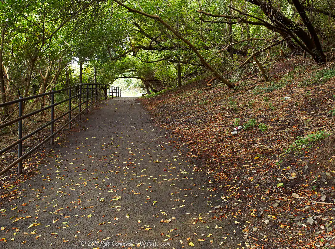
Description: From the Maplewood Park parking lot off of Driving Park, head towards the restroom building to the east (opposite the rose garden). There is a trail-head here that leads into a wooded area a little bit into the gorge. Follow this trail down into the gorge and then to the right. It will pass under the Driving Park Bridge and open up to a viewing area for the top half of the falls. Continue on this path to reach Lower Falls park. The park is built upon the foundations of the McCrackenville mill settlement dating back to the 1820s. A viewing area in the park will provide an excellent opportunity to see the falls crest close up, as well as the Driving Park Bridge. The trail loops the park, and along the way you can see historic signs about the mills once here as well as the construction of the Middle Falls dam.
From the south end of the park, a single paved trail leads over the dam. You can continue on the trail which ends at St. Paul Street in the city or turn back.
Maplewood Park & the old gorge trail
Difficulty: Moderate to difficult depending on trail conditions.
Markings: A few park signs and paved trail.
Distance: About a quarter mile over rough terrain.
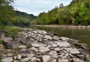
Description: From the Maplewood Park parking lot off of Driving Park, head towards the restroom building to the east (opposite the rose garden). There is a trail-head here that leads into a wooded area a little bit into the gorge. Hop the railing here. You are going off the main trail. Head down-hill towards the gorge. You will pick up a dirt trail along the gorge that heads left (north). Follow this and be careful not to get too close to the gorge trail. In times of rain and wet ground, forget this trail. It will be too slippery to traverse safely. At one point the trail hugs an open dirt cliff. Use extreme caution here. The trail is extremely slippery. Shortly after, you will reach an area where the trail breaks up. There are larger rocks leading down into the gorge. Descend here. Once at the banks of the Genesee, head right (upstream) towards the falls.
Maps: Genesee Valley Greenway Trail Map (PDF); Fishing access map; Interactive Map.
Rochester Lower & Middle Falls Interactive Map
Rochester Falls Media


Interesting Stuff
The Gorge in Winter
Most falls are not very impressive in winter. Low water flow and lack of green foliage tend to be a little depressing. The amount of water flowing over these falls in winter, combined with the frigid air, creates spectacular and massive icicles along the towering gorge walls. The RG&E access road will lead you safely down the gorge giving a great view of the frosted gorge.
The Maplewood Rose Garden
Located off of Driving Park Ave., this 1+ acre garden features over 3,000 rose bushes and hundreds of varieties. The best time to visit is the second week in June when the roses are in full bloom and the Rose Festival is taking place.
McCrackenville Clues
With caution, you can explore the water’s edge of Lower Falls Park to see some of the foundations of the mills that once existed here. More remnants of this old mill settlement can be found along the overgrown cliff on the side of the park opposite the river.
Old Pavilion
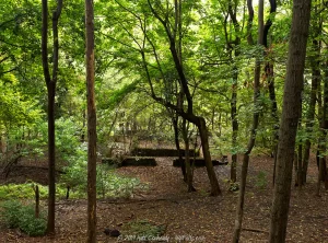
Off the trail in Maplewood Park, in that wooded area heading down into the gorge, are the concrete ruins of a large falls-view pavilion that was once here.
Photography Tips
Driving Park Fence
- The Driving Park Bridge offers an excellent vantage point to see Lower Falls and the gorge. The problem is the 10 ft tall chain link fence. Most sizable lenses can’t shoot through it. This is the perfect time to bring that compact camera with that tiny lens opening. Shoot right through the chain link fence to nail the shot.
Mist
- Be mindful of mist when shooting from the viewing platform on the eastern side. Bring a soft but absorbent lens cleaning cloth and wipe your lens frequently.
Silky Water Effect
- To get that smooth cotton-candy look to the falls, you need to use a Neutral Density (ND) filter on your lens. The ND filter will block some of the light from entering the lens without altering the color, and thus allow your shutter to stay open longer. This blurs the water and creates a soft white gloss to the foamy areas of the falls. Check out the article for the all the details.
More tips
- See the Articles for more photography tips.

Who to Contact
Maplewood Park
City of Rochester
Parks and Recreation Division
400 Dewey Avenue
Rochester, New York 14607
Phone: (585) 428-6690
Fishing Access Site
NYSDEC Region 8
6274 East Avon-Lima Rd.
Avon, NY 14414-9519
Phone (585) 226-2466
[email protected]
