Page 1 of 1
Mossy Cascade Brook
Posted: Sat May 15, 2010 6:31 am
by backpacker
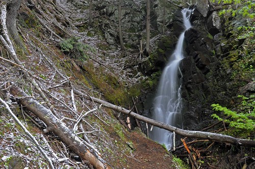
This 40 foot waterfall is .75 miles off route 73. The trailhead is on the south side of the bridge that crosses the East Branch off the Ausable River, ½ mile north of the road to the Ausable Club in St. Huberts. The hike in is easy and flat for the most part, it will take 20 to 30 minutes to reach a small sign the points left for the cascade/falls. At the sign you follow the faint trail up the creek to the falls. You’ll climb over or under a couple fallen trees and see the first small waterfall, at this point you can hear the larger fall a mere 100 to 150 feet ahead. Cross the creek near the base of the falls to get the best pictures. In high water flow this would be near impossible to reach.
The lower falls
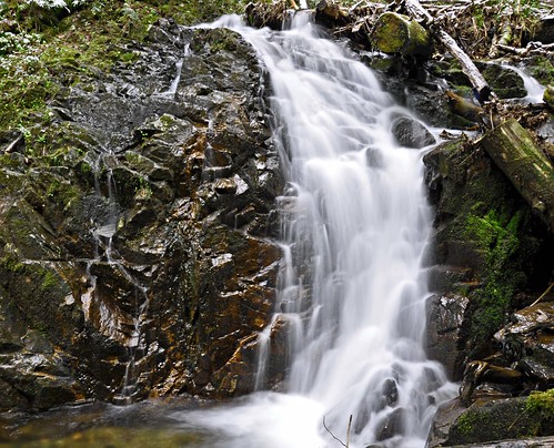
View from the right side of the creek

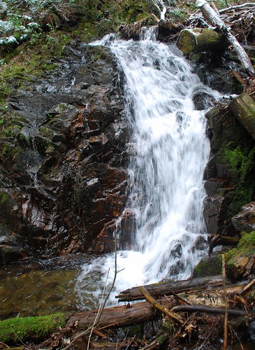
Views from the left side of the creek
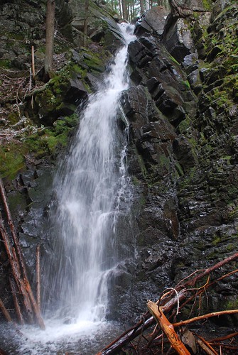
Top of the Falls

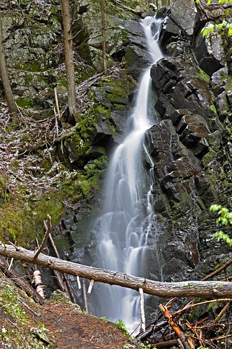
The main falls
Re: Mossy Cascade Brook
Posted: Sat May 15, 2010 6:37 am
by George
Thanks for the detailed directions. Definitely one to check out
Re: Mossy Cascade Brook
Posted: Thu May 20, 2010 12:29 am
by Matt
Love them all! And the contrast is superb. Excellent work!
Re: Mossy Cascade Brook
Posted: Sat May 22, 2010 2:51 pm
by backpacker
Matt wrote:Love them all! And the contrast is superb. Excellent work!
Thanks Matt,
was a great day to shoot, set the tripod, high F stop (F11-F20), no filters needed, the waterfall is deep in the pines and a narrow ravine.
Re: Mossy Cascade Brook
Posted: Sat May 22, 2010 3:52 pm
by hobkyl
More

Re: Mossy Cascade Brook
Posted: Sat May 22, 2010 8:08 pm
by backpacker
hobkyl wrote:More
Wide view
The bottom

Small falls below the lower falls

Re: Mossy Cascade Brook
Posted: Thu May 27, 2010 1:20 pm
by L_G_D
Nice shots. I just scanned the ones I took a few years ago, a bit less water then. Need to get these linked up to the main page.
Re: Mossy Cascade Brook
Posted: Fri Aug 26, 2016 12:21 pm
by Des219
We attempted this falls but I think the sign is no longer there for the turn off. We realized when we got to the part where you cross the creek that we had gone too far. We decided to hike Hopkins Mt. And when we came back I saw a trail leading along the edge to the falls. It was steep and not much to keep you from going over the edge. I did see the falls but not a good enough location and too slippery for a picture. The only good way would be along the creek but we were too tired from the Mt. Hike to tackle the bolders and fallen trees.
Note, they are doing construction on most of the bridges on 73 so the signs marking the water ways were missing. Just look for the one right before St Hubert's sign and park on the small pull off (if heading south east).