Page 2 of 4
Re: mystery falls along route 73
Posted: Wed Aug 06, 2008 5:38 am
by paulschw
Here's a photo of another falls off of 73 that comes off of Cascade Mtn.
right near where Upper and Lower Cascade Lakes meet. There is seldom
any significant water flow, but there was this past spring.


Re: mystery falls along route 73
Posted: Wed Aug 06, 2008 7:31 am
by cbobcat49
I've seen this falls on Matt's list. We must have walked right past it last fall as we climbed Cascade Mtn last fall. It must not have been flowing then. Not that I knew to look for it. I didn't know it was there then.
Re: mystery falls along route 73
Posted: Thu Aug 07, 2008 9:51 am
by backpacker
That is the top part of Roaring Brook falls. One of these times I'll stop and climb up there, the trail starts on the bottom right of Roaring Brook.
Re: mystery falls along route 73
Posted: Thu Aug 07, 2008 12:04 pm
by cbobcat49
About how tall would you say it is total? In the nyfalls list it says 100 feet but what I saw seemed much higher than that.
Re: mystery falls along route 73
Posted: Thu Aug 07, 2008 6:07 pm
by Matt
the book says "over 100ft in two segments."
Not much help, it's obviously more than 100 ft
I'm re-naming the topic and linking it in.
Re: Roaring Brook Falls
Posted: Thu Jul 23, 2009 9:13 am
by L_G_D
Roaring Brook is another favorite of mine, right up there with Split Rock. It's a completely different waterfall though, where Split Rock is huge and chunky and powerful, Roaring Brook is wispy and gossamer and tends to disappear in dry weather. From what I understand, there's a dam somewhere upstream that diverts the water from another channel into the one over the falls. I've never been up there to see it that I recall, so I can only say that much about it. Seem to remember reading that in a hiking guide.
First, the Google Map
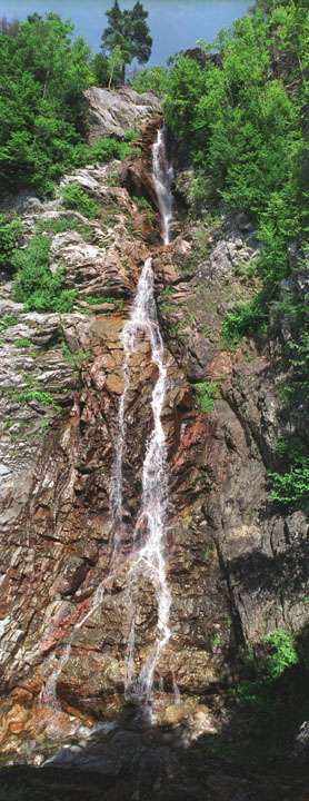
There is a popular pulloff on Rte 73 halfway down the hill from Chapel Pond that gives a good long-distance view of the falls. If you stop in the right place, you don't even need to get out of the car. Here's a shot from June when the water was about as high as I've seen it.
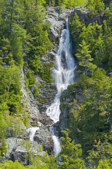
That's the picture most people see, since it's the easiest to get. If you park at the hiker's parking at the bottom of the hill, you can walk the half mile for so to the bottom of the falls:
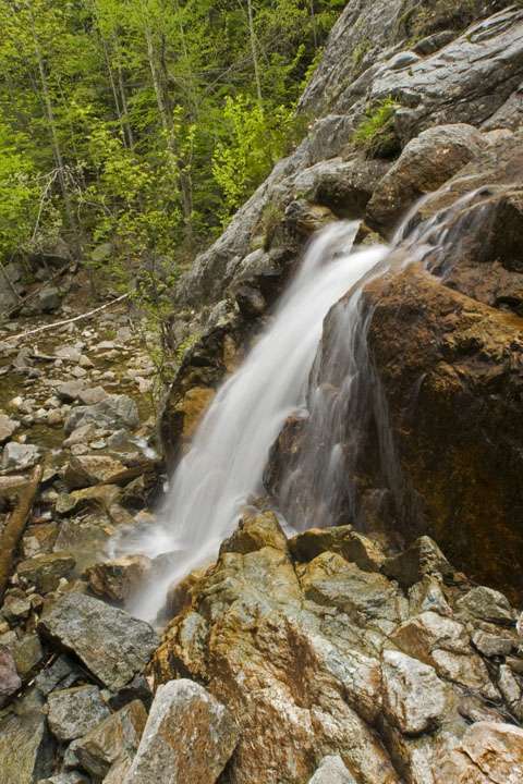
Scramble up a bit and you get the next view
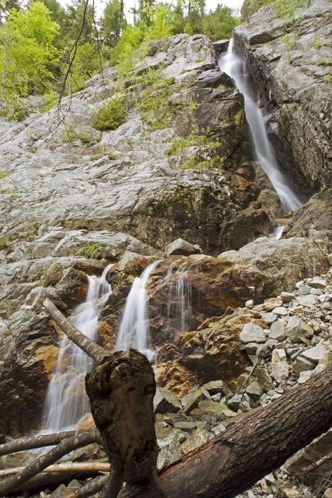
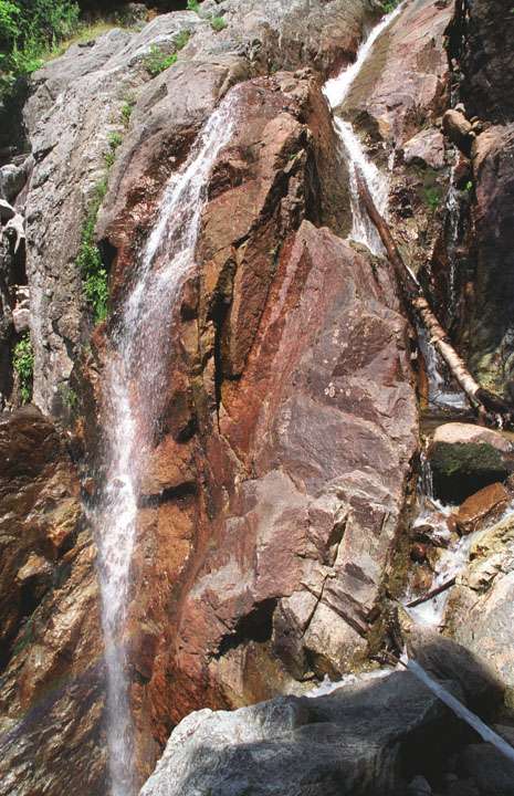
A lot more scrambling gets you this view, this section is not visible from the road or from the bottom:
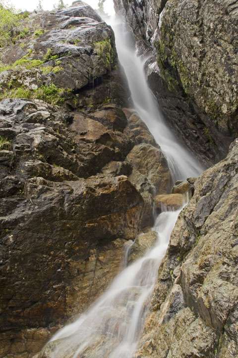
Once you start getting towards the top, you'll be able to see the section that's visible from the road:

Even more effort and a really bad hand-held panorama later, and you'll see the top section.
I need to get back there and do this again with decent equipment. The lens I used for these older shots had a lot of chromatic aberration and weird distortions.
Total height? Easily well over 200 feet, maybe closer to 300 or more. About the only way to measure it would be to get a really accurate GPS with altitude reading at the top & bottom.
Re: Roaring Brook Falls
Posted: Mon Jul 27, 2009 10:58 am
by Matt
some of those photos remind me of an Escher drawing.

Re: Roaring Brook Falls
Posted: Mon Jul 27, 2009 12:11 pm
by L_G_D
Yeah, I know what you mean. There isn't a lot of room to stand while climbing the falls, and getting to a good place to take a picture is tough. So, ultra-wide angle lenses and stitched panoramas are the only way to go.
I might see if I can convince a friend to climb them again this year and see what I can get with more modern equipment.