
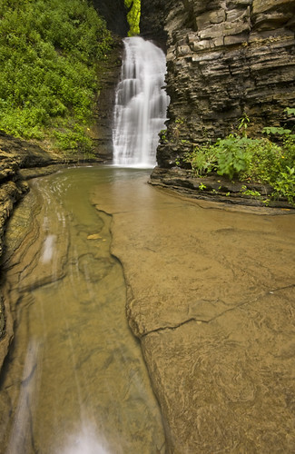
Deckertown Falls
-
hobkyl

- Moderator

- Posts: 2671
- Joined: Thu Aug 14, 2008 8:55 am
- Camera Model: Pentax K30
- Location: Victor, NY
-
spec
- Senior Guide

- Posts: 386
- Joined: Mon Oct 26, 2009 3:09 am
- Camera Model: Canon Rebel T1i / Samsung S730
- Location: Endicott, NY
I'd be interested in that trip! With Shequaga, Aunt Sarah's, Excelsior, and Quarter Mile Glen -- not to mention Watkins Glen -- all right in that area (to name a few), we could even do a multi-falls trip.
-----
spec
spec
-
champy1013
- Lead Contributer
- Posts: 708
- Joined: Sun Apr 10, 2011 12:45 pm
- Camera Model: Canon EOS 5D Mark IV
- Location: Skaneateles
-
hobkyl
- Moderator
- Posts: 2671
- Joined: Thu Aug 14, 2008 8:55 am
- Camera Model: Pentax K30
- Location: Victor, NY
Nice one Matt!  Im starting to get the itch, think I might try to check out Stemple Hill this weekend if weather pans out. Last year at this time, I had already been out to several falls and in the creeks with temps in the mid 40s up to the mid 70s. I like winter, I really do...but Im ready for Spring!
-
Matt

- President
- Posts: 13374
- Joined: Sun Apr 23, 2006 5:01 pm
- Camera Model: Olympus OMD EM-1 m1, m2; Panasonic GM5, Osmo Pocket
- Location: Rochester, NY
- Contact:
Work is underway on this page and I have a preliminary rough map up. I don't really recall much about the hike I did, and unfortunately although I tracked the hike on the GPS, I must have deleted the photos I took with so now I can't plot the upper falls correctly on the map. I'm not sure how far my maps extends beyond the last falls. It looks like I went pretty far.
The map is open to edit. Please contribute if you have any relevant info.
http://maps.google.com/maps/ms?msid=218 ... 3,0.007049
The map is open to edit. Please contribute if you have any relevant info.
http://maps.google.com/maps/ms?msid=218 ... 3,0.007049
-
hobkyl
- Moderator
- Posts: 2671
- Joined: Thu Aug 14, 2008 8:55 am
- Camera Model: Pentax K30
- Location: Victor, NY
It looks like you went pretty darn far is right. My gps app never did get converted (issues). Best guess? I'd say you covered them all. I look forward to getting there in the spring and will count.
-
bremer
- Senior

- Posts: 136
- Joined: Wed Apr 29, 2009 11:06 pm
- Camera Model: Sony Alpha 230
- Location: Blacksburg VA
- Contact:
When I was here last summer the trail along the north-rim was posted not too far above the bridge. Does anyone know how much of the gorge the town owns aside from the lower falls/parking area?
"Now I see the Secret of the making of the best persons. It is to grow in the open air and to eat and sleep with the earth" - W. Whitman
Roots Photography
Roots Photography
-
Matt
- President
- Posts: 13374
- Joined: Sun Apr 23, 2006 5:01 pm
- Camera Model: Olympus OMD EM-1 m1, m2; Panasonic GM5, Osmo Pocket
- Location: Rochester, NY
- Contact:
The land to the right of the trail is posted. It always has been, but it seems the trail itself, and that small sliver of land doesn't have signs. Not 100% sure though.

