Bouquet River - North Fork & Gorge
Posted: Thu Jun 25, 2009 9:17 pm
We have a running joke about how the Bouquet River is pronounced - or spelled. The USGS 1:25 000 maps have it spelled Bouquet, the 1:100 000 maps spell it Boquet - I've heard it pronounced bo-kay, boo-kay, bo-kwet & bo-ket, so you have your choices, just don't pronounce it "wrong" when speaking to certain locals who "know" they are pronouncing it right. LOL
Another interesting factoid, the Bouquet is the steepest river in New York State, being just about 45 miles long, it drops something like 3,000 feet. So, you think there'd be some waterfalls on it? Well, of course there are. One set is the famous & spectacular Split Rock. That has it's own thread and I'll post some pics to it when I get them together. Being the easiest ones to get to, I have taken a lot of pictures there over the years. But, this post is about the much lesser known gorge on the upper reaches of the north fork of the river, above where it crosses route 73.
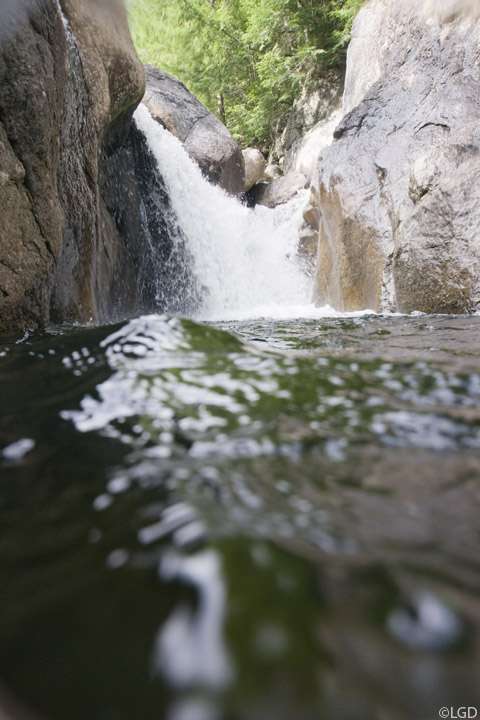
The first falls on what I call the upper north fork are right next to the road. Generally just called the Route 73 Flume, it's a great place to go swimming in the summer, and jump off the cliffs. You can get pictures from the shoulder of the road with a longish lens, or, you can scramble down to the top of the retaining wall and get shots from closer to the water. With more effort, you can scramble down further and get shots from stream level. With even more effort, a lot more scrambling and low water, you can get a shot from the rock that is stuck between the cliff walls and get up close & personal:

That's about my favorite shot of these I've ever taken. This was in 1999 when it was a dry summer and water was very low. Usually, the rock I'm standing on is under fast moving water and is a little waterfall itself.
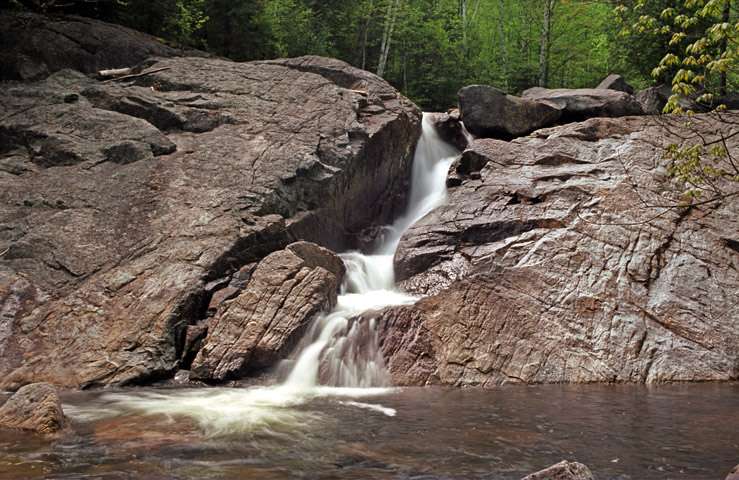
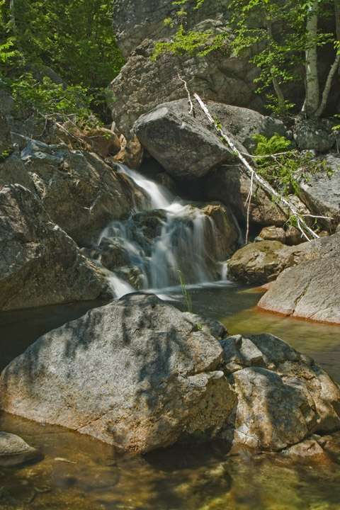
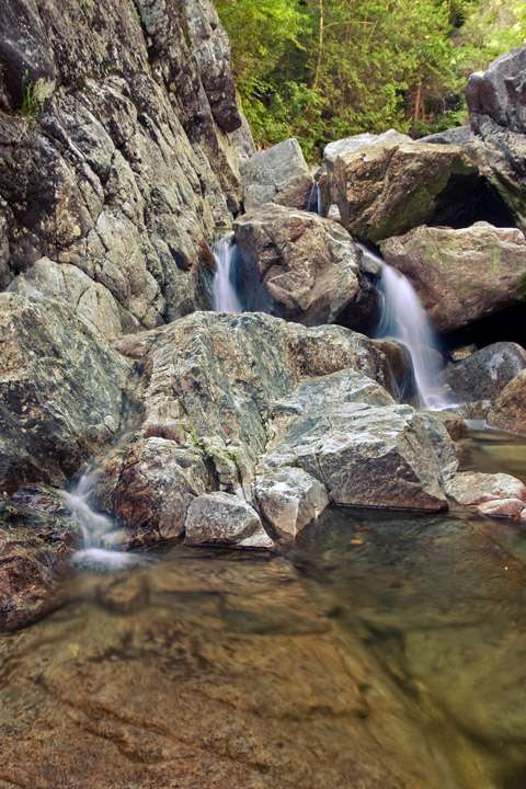
Heading upstream from the road, the next waterfall is another favorite summertime swimming, picnicing & camping spot. The river flows into a crack in the bedrock that is so narrow the waterfall might as well be in a cave. One of these days I'll get there with the right light & be able to get a shot (see post below). Until then, we move onto the next waterfall, the last one on the lower portion of the river, until it enters the gorge. This one has no name as far as I know:

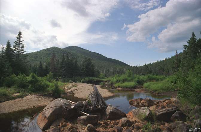
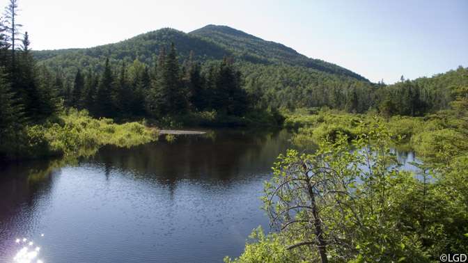
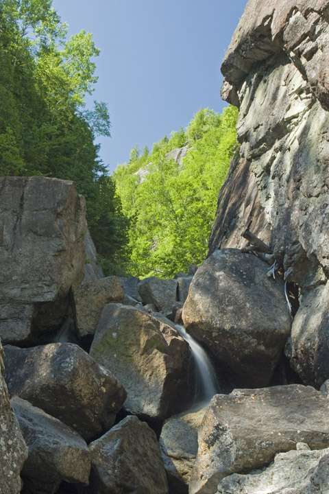
After that, the river flattens out and becomes your average mountain stream with nice pools to fish in shaded by the forest. Once you start climbing, it becomes more active and eventually you approach the gorge and start to see waterfall after waterfall:

Once you get into the gorge itself, the walls rise about 100 feet from the river and you are committed to hiking through, there's no way to climb out and bushwack over to the trail:
There were actually one or two falls below this that we just didn't have time to take pictures of, we needed to make some time and I knew there were more & bigger falls ahead.
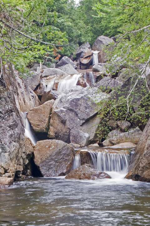
This is an overall shot of what I call the staircase. Four or five falls, one after the other with a nice pool at the bottom
First one, number two in background
Closer shot

Second one

From the side
Three & Four
Above the staircase, the gorge starts to close in & narrow, and gets steeper just before it ends, the waterfalls are close together separated by pools
Here's a google map of the area
Edit: Fixed broken links
Another interesting factoid, the Bouquet is the steepest river in New York State, being just about 45 miles long, it drops something like 3,000 feet. So, you think there'd be some waterfalls on it? Well, of course there are. One set is the famous & spectacular Split Rock. That has it's own thread and I'll post some pics to it when I get them together. Being the easiest ones to get to, I have taken a lot of pictures there over the years. But, this post is about the much lesser known gorge on the upper reaches of the north fork of the river, above where it crosses route 73.
The first falls on what I call the upper north fork are right next to the road. Generally just called the Route 73 Flume, it's a great place to go swimming in the summer, and jump off the cliffs. You can get pictures from the shoulder of the road with a longish lens, or, you can scramble down to the top of the retaining wall and get shots from closer to the water. With more effort, you can scramble down further and get shots from stream level. With even more effort, a lot more scrambling and low water, you can get a shot from the rock that is stuck between the cliff walls and get up close & personal:
That's about my favorite shot of these I've ever taken. This was in 1999 when it was a dry summer and water was very low. Usually, the rock I'm standing on is under fast moving water and is a little waterfall itself.
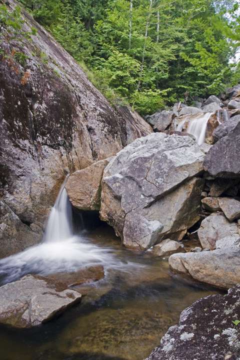
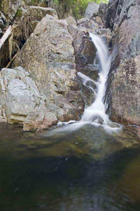
Heading upstream from the road, the next waterfall is another favorite summertime swimming, picnicing & camping spot. The river flows into a crack in the bedrock that is so narrow the waterfall might as well be in a cave. One of these days I'll get there with the right light & be able to get a shot (see post below). Until then, we move onto the next waterfall, the last one on the lower portion of the river, until it enters the gorge. This one has no name as far as I know:
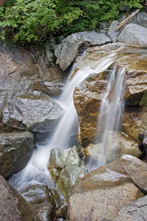
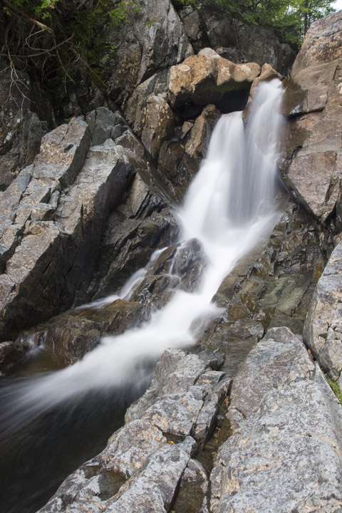
After that, the river flattens out and becomes your average mountain stream with nice pools to fish in shaded by the forest. Once you start climbing, it becomes more active and eventually you approach the gorge and start to see waterfall after waterfall:
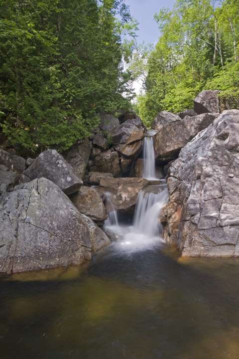
Once you get into the gorge itself, the walls rise about 100 feet from the river and you are committed to hiking through, there's no way to climb out and bushwack over to the trail:
There were actually one or two falls below this that we just didn't have time to take pictures of, we needed to make some time and I knew there were more & bigger falls ahead.
This is an overall shot of what I call the staircase. Four or five falls, one after the other with a nice pool at the bottom
First one, number two in background
Closer shot
Second one
From the side
Three & Four
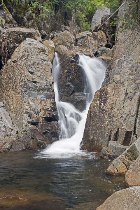
Above the staircase, the gorge starts to close in & narrow, and gets steeper just before it ends, the waterfalls are close together separated by pools
Here's a google map of the area
Edit: Fixed broken links